Chapter 15b/14b Stream Systems and Landforms
Geosystems, 4CE, pp. 453-486 (Geosystems, 3CE, pp. 419-449)
Make sure you read 15a for the midterm exam, too.
Make a joyful symphony before the LORD, the King!
Let the sea and everything in it shout his praise!
Let the earth and all living things join in.
Let the rivers clap their hands in glee!
Let the hills sing out their songs of joy before the LORD.
For the LORD is coming to judge the earth.
He will judge the world with justice, and the nations with fairness.
Psalm 98:6-9 NLT
**There is a video version of this lecture here: https://youtu.be/KNZ9cY3vUko
**The exam is based on the content in these notes, so please print them off to study from.
Rivers or streams are key components of the Earth’s natural systems. They transport water, minerals, living organisms, and sediment vast distances. They make varieties of life feasible in otherwise arid environments. They provide water, transportation, and waste removal resources for plant and animal life and people. They sustain vast amounts of life within themselves and form a critical part of many food chains. Some of world’s rivers are staggering in the amount of water and sediment they transport and discharge. The world’s largest rivers are:
- the Amazon River (largest discharge: discharging almost 20% of all water carried by all the rivers of the world)
- the Nile River (the longest river in the world … although Brazilians will argue this!)
- See Table 15.1, “Largest Rivers on Earth …” p. 454 4CE (14.1; 3CE, p. 421).
The largest rivers in Canada, by discharge, are the St. Lawrence River System, and the MacKenzie River System. The longest in Canada is the Mackenzie–Slave–Peace–Finlay river system in the North West Territories, northern BC, AB, SK, and MB.
This page will look at river/stream systems and their associated landforms. These processes are often referred to as “fluvial” processes (from the Latin fluvius = river). Hydrologists often prefer the more general term “stream” to “river.” Streams include any overland flow of water … including rivers. Rivers tend to refer only to large streams. The term stream includes all rivers (and smaller flows including brooks, rivulets, creeks, etc., etc.)); the term river refers to only large streams. We will use the more general term stream.
Streams are important agents in erosion (the transport of sediment). Sediment is transported by rivers and deposited elsewhere as alluvium — a general term for material deposited by running water. Don’t worry about the discussion of base levels.
-
STREAM SYSTEMS
Drainage Basins
Stream systems are usually divided into drainage basins. Drainage basins include all the land that a particular stream system drains. a drainage basin can be thought of as that particular stream system’s catchment area – all the precipitation that falls in that particular area drains into that particular stream system. For example, all the rain that falls
Drainage basins are self-contained units, bounded by a drainage divide. See Fig. 15.2, 4CE, p.455 “A drainage basin” (Fig. 14.3, 3CE, p.423), and Figure 15.3, 4CE, p. 456 “Drainage basins and continental divides” (Fig. 14.5; 3CE, p. 424).
A drainage basin can also be called a watershed.
A drainage basin, then, is the area drained by a stream and its tributaries (and subsurface geologic structures), separated from adjacent basins by drainage divides. Drainage divides are the ridge, hills, or other higher ground that separates one drainage basin from another. At a local scale, for instance, all the streams in a single valley drain into the river system of that valley. This is the drainage basin. The ridges that separate that valley from the adjacent valley (which is its own drainage basin) is the drainage divide.
Drainage basins vary because of the topography, geology and climate affecting the area. The character of the streams and groundwater movement will be affected by these characteristics (below).
Canada has five major drainage areas. Find your home drainage basin on Figure 15.3, (4CE, p. 456; Fig. 14.5; 3CE, p. 424) or below:
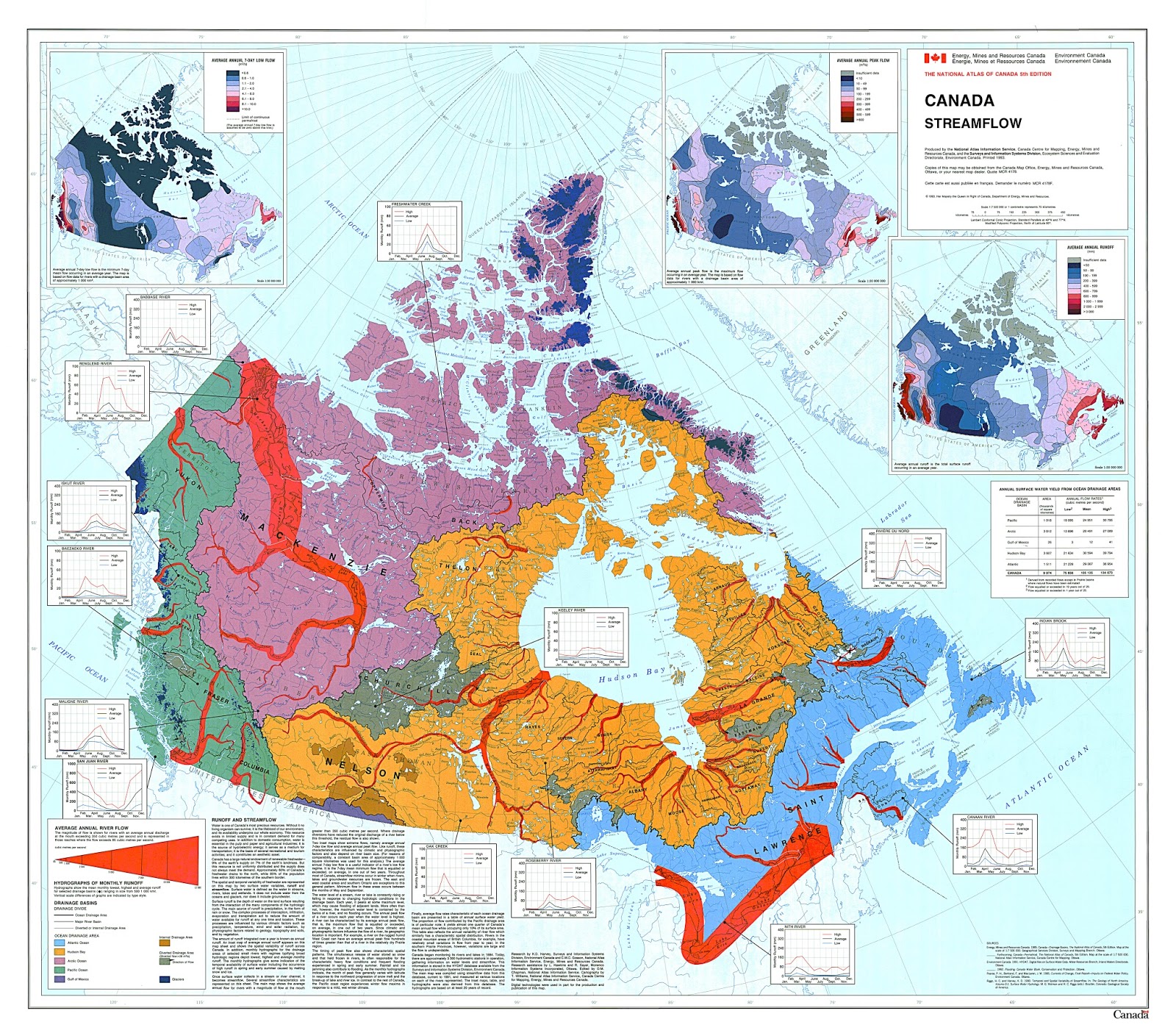
Note that there are major continental divides in North America (dark blue lines on Figure 15.3 (4CE)/14.5 (3CE)). These separate all the drainage basins that flow into the various oceans. There are dozens of smaller drainage basins/drainage divides within each of these large scale drainage areas.
– all basins west of the Rockies flow to the Pacific Ocean
– basins east of the Rockies and north of the Athabasca River flow to the Arctic Ocean
– basins east of the Rockies, north of about 49° and the Great Lakes flow to Hudson Bay
– basins east of the Rockies, south of 49° sand the Great Lakes, but east of the Appalachians, flow to the Gulf of Mexico (the only Canadian River system that drains south is the Milk River in very southern Alberta)
– Great Lake and St. Lawrence basins flow to the Gulf of St. Lawrence
– Basins east of the Appalachians flow to the Atlantic Ocean
To which ocean/bay/gulf does your home basin flow?
Here is a cool map of Canada mapped only by lakes, rivers and streams (more regional, detailed maps are here):

Drainage Density
An important characteristic of a drainage basin is its drainage density. This is a measure of how many km of streams there are within a specific area (km2).
Drainage density is defined as the average length of stream channel per unit area of the basin:
Dd – drainage density (km/km2)
Dd = ΣL ΣL – sum of all stream lengths (km)
A A – drainage basin area (km2)
So … what does that mean???
A basin with a relatively high drainage density is well-drained (it has many streams).
A basin with a relatively low drainage density is poorly drained (it has few streams).
A well-drained basin is great in a very wet area … after a rainfall, the water is quickly and easily removed. However in arid areas, being well-drained is not necessarily good! You want the water to stay! So people create a dams, reservoirs and other artificial ways of decreasing drainage density. Southern Alberta (where I live) is well-drained, but farmers want the water from precipitation to stay! So extensive water control systems — dams, reservoirs, and canals — have been built to reduce runoff.
In a very wet area, a poorly drained basin is a problem! When rain falls, the water doesn’t go anywhere! The results are swamps, bogs, and local flooding! In this case, people may increase drainage density by digging drainage ditches, floodways, dikes, even whole new rivers to improve drainage! In arid areas, people often create poorly drained basins, so water collects in dugouts or other artificial storage facilities.
Drainage in a basin is not only related to how many streams there are, but also how much water infiltrates the soil and moves as groundwater as opposed to how much runs off into streams and rivers. Some soil/rock is porous or permeable: it allows water to soak in and become interflow or bedrock flow (in aquifers). Other soil/rock is nonporous or impermeable: it does NOT allow water to soak in and become groundwater:
I – infiltration
I = P – R P – precipitation
R – runoff (stream flow)
- If infiltration is high, groundwater levels are high. Little runoff (stream/river flow) occurs, and relatively few streams will develop.
- If infiltration is low, groundwater levels will be low. Much runoff occurs and stream development is more likely.
Infiltration is directly related to:
- Geology
- some rocks have higher infiltration capacities, such as limestone, sandstone, gravel, and fractured rock
- some rocks have lower infiltration capacities, such as shale, clay, igneous rock
- regions with well developed soils have higher infiltration capacities
- regions with little soil development have lower soil infiltration capacities
- Topography
- flatter slopes have more potential infiltration than steeper slopes
- Vegetation
- regions with much vegetation have higher infiltration potential than regions with little vegetation. Roots tend to break up soil/rock so water can infiltrate. Vegetation also “traps” water so it doesn’t run off the surface so easily.
- Urbanization
- in general, human activity (paving, building, etc.) reduces infiltration by creating hard, impermeable surfaces of concrete, asphalt, packed ground, and buildings.
Think about the West Edmonton Mall — 49 hectares (121 acres) of land with absolutely 0 infiltration capacity — all the precipitation that falls runs off into the storm sewer/North Saskatchewan River. During severe summer rainstorms, the WEM severely tests Edmonton’s storm sewer system … 49 hectares of storm water has to be accommodated. The area around the WEM … roads, hotels, hospitals, also has low infiltration capacity, further stressing the city infrastructure.
Or consider the Boeing Everett [WA] plant – where 767s etc. are built. This is the largest building by volume in the world — the roof area is 52,000,000 m2 (472,000,000 ft2). Given the high annual precipitation in the Pacific Northwest (Everett is near Seattle), all that rain must runoff … none will infiltrate. Boeing has to store rainwater during heavy storms and release it during dry periods so they do not wash away Everett, downhill from the plant, with all the runoff!
The challenge in any city — large like Toronto or Vancouver, or smaller like Regina or Moncton — is how to accommodate heavy precipitation events when so much of the ground’s infiltration capacity has been removed as a result of urbanization. Can we build storm sewers big enough? Where does the outflow go?
After the devastating Alberta floods of 2013, this topic is very much in the news: Calgary floods spotlight cities’ costly failure to plan for climate change – Canada – CBC News
Drainage Patterns
Not all streams look the same on the landscape. The often create different drainage patterns, which look different from the air.
The pattern which streams make tends to vary in response to
- geology,
- climate, and
- topography
(see Figure 15.5 4CE, p.458 (Fig. 14.9; 3CE, p. 427) “The seven most common drainage patterns”)
- dendritic drainage patterns (from dendros = tree) — in regions with gentle slopes and similar materials, a pattern not unlike the pattern of veins in a tree leaf develops. (This is very common on the Prairies/the U.S. Midwest, and in flat drainage basins — like Amazon).
- trellised drainage patterns — tend to develop in regions with folded sedimentary layers. In these areas there is often a series of parallel ridges and valleys. The rivers flow in the parallel valleys between the folds. They look kind of like a garden trellis.
- radial drainage patterns — form around a mountain or hill, as streams flow outward from a central peak. These are common around volcanoes such as Mt. Ranier.
- parallel drainage patterns — tend to result on steep, uniform slopes, especially on loose materials (check out the drainage patterns on a road cut). These are several parallel gullies running downslope.
- rectangular drainage patterns — tend to develop where faults or joints guide stream channels along straight lines
- annular drainage patterns -– occur on a dome of parallel strata, where rivers tend to go in a circular pattern.
- deranged drainage patterns — a mess! No discernable pattern! Usually because there has been a complicated history such as repeated glaciation, erosion and deposition. These often occur in areas with little slope and a variety of bedrock/sediment/soil surfaces.
B. STREAM FLOW CHARACTERISTICS
Streams flow! They channel water (and dissolved compounds and solid materials) down slope, toward the ocean.
Stream water comes from direct precipitation, overland flow (runoff), inflow from tributaries, seepage from the bed, and melting snow and ice.
Streams flow down slope under the influence of gravity! (I hope that’s not a new concept!)
Streams have a gradient – slope. In general, streams are steeper near their headwaters (for instance in the Rocky Mountains) and have a shallower slope downstream (for instance near the mouth of the river, where the river drains into the ocean.
Streams discharge water downstream. In general, stream flow and stream discharge increase the further downstream the flow is measured. As more tributaries drain into the stream and more runoff occurs, the greater the flow in the stream. Human activity – such as removing water for irrigation – can, of course, change this.
Measuring Stream Flow
Stream flow is measured as Q (quantity), expressed in terms of cubic metres per second (m3/s) of discharge. The Amazon is the largest river system by this measure — discharge — see Table 15.1, p. 454 (Table 14.1; 3CE, p.421).
Q = v x w x d Q is stream flow (quantity of water in m3/s)
v is stream velocity (in m/s)
or Q = v x A
w is average stream width (m)
d is average stream depth (m)
A is average cross sectional area (w x d, in m2)
Note that if a narrow stream can be carrying as much water as a very wide stream, if the narrow stream is very deep or flowing very quickly (or both).
 In the Fraser River Canyon (BC), Hell’s Gate (right) is a very narrow part of the canyon. But the flow is very high (twice as much water as Niagara Falls). Here the water is flowing very quickly. And it is very deep (over 100 m deep). You cannot judge how much water is flowing in a river simply by how wide it is!
Note that hydro-electric projects (which depend on stream flow to turn turbines located in dams to generate electricity) simply rely on high stream flow (Q). So … they can be built on slow streams, if the stream is wide and/or deep. This is the case in fairly flat regions like Siberia, where streams tend to be slow, but wide. These dams have to be huge. In flat areas, dams have to extend vast distances or streams simply go around them! These dams constitute a high economic investment for moderate economic return (moderate flow, therefore moderate hydro generation).
Or … ideally, hydro dams can built on narrow, fast, deep streams (the highest flow), often in confined, relatively easily dam-able canyons or deep valleys. In western Canada/U.S., which are mountainous, engineers love to build hydro projects on narrow, fast, deep streams (like the Grand Canyon). These projects provide the highest economic return (high flow, therefore high hydro generation) for the least investment (smallest dam).
Stream flow can also be measured by a hydrograph, which shows stream flow over time. This is particularly useful to study stream flow after a storm event …
-
Stream Velocity (v)
Think of a really long river … the Fraser, the North Saskatchewan, the Mississippi. Over the entire length of the stream, the velocity (speed) of the water changes
It varies in response to slope — the steeper the slope, the faster the flow; the shallower the slope, the slower the flow.
Usually streams are steepest, thus fastest, near their source or headwaters (for instance in the mountains).
Streams are usually least steep, thus slowest, at their mouths (for instance near the ocean).
Within any given stretch of the stream:
– top to bottom, velocity is greatest at the surface of the stream, least on the bed (because of friction, slowing water down at the bottom);
– side to side, velocity is greatest in the centre, least on the sides along the banks (again because of friction, slowing water down along the banks)
 So, the fastest place in a stream is right at the surface in the centre of the stream (notice this in the photo of Hell’s Gate, above). The slowest place will be along the banks or the bed. Winne-the-Pooh’s favorite game is “Pooh Sticks” — you and a friend drop sticks into a stream on one side of a bridge and see whose makes it to the other side first. Winnie-the-Pooh is wise enough (believe it or not!) to know that the best place to drop your stick in is in the center of the stream! Now you know how to win at Pooh Sticks … drop your stick right in the middle, because that’s where the water is flowing fastest.
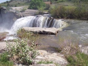
This has implications for waterfalls — among other things (see Lundbreck Falls, AB, right)! Because the water is flowing fastest in the centre of the stream, it is most erosive in the centre of the stream! Therefore wide waterfalls tend to erode backwards (upstream) most in the centre of the stream. Wide waterfalls tend to develop a horseshoe shape (like Horseshoe Falls @ Niagara Falls). The stream erodes greatest in the centre and least along the banks. If you look at any well-developed, wide waterfall, it always has a horseshoe shape, with maximum erosion (from maximum stream velocity) in the middle.
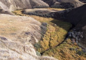
- The line of maximum river flow velocity is called the thalweg. The thalweg will be at the surface, in the centre in a straight stream.
- In a meandering (curved) stream channel, the thalweg will weave from side to side. See the dark line of open water in the photo to the left (Three Mile Coulee, AB)
Know this — it is really important safety information for swimming in a river! And you may need to know it on an exam! (hint)
-
Stream turbulence
Stream is closely related to stream turbulence. Stream flow is described as either:
- laminar flow — where the water flows over a smooth bed. Water tends to flow quickly with little turbulence and little vertical mixing. Laminar flows do not entrain (pick up) materials well because there is little vertical lift (the water just goes merrily along). Laminar streams usually are clear … you can see the bed. You wouldn’t mind drinking the water.
However if sediment is already entrained, laminar flows transport materials well because there is no friction. Things don’t collide with the bed or banks.
2. turbulent flow — where the water flows over a rough bed. Water tends to flow less quickly, but with lots of turbulence and considerable mixing. Turbulent flows are much more erosive and entrain more material than laminar flows because of the “lift” force … the water and everything else is bouncing all over the place! Turbulent streams are often “dirty,” because they are picking up lots of stuff.
However they don’t transport sediment particularly well, because the sediment is often entrapped by rocks, branches, and other obstacles on the bed or banks..
D. Stream Channel Shape
-
Meandering Streams
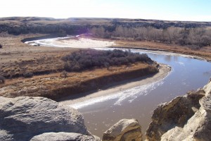 Stream channels are not all the same shape. Some streams are very straight. Most, however, develop curves, called meanders. The image to the left is of the Milk River in southern Alberta.
Meanders are named after the Büyük Menderes River in Turkey, which twists and curves for 615 kilometers. The river’s sinuous path captured the attention of historians and geographers of antiquity. Strabo wrote of its extreme windiness, and Herodotus referenced its twisting nature. The river’s ancient Greek name Maíandros, or Maeander, became synonymous with the bending character of river courses, and the modern geographical term “meander” was born.
Meanders are most developed in areas with shallow slopes and low velocities (wide, flat valleys).
Over time, most rivers tend to become curvier and curvier … more meander-y! Meanders tend to grow as the thalweg causes erosion on the outside of curves and deposition occurs on the inside of curves. Note that rivers erode on the outside of curves. The outside of curves often results in steep cliffs, continually undercut.
Above, the Milk River is actively eroding the outside of curves while depositing on the inside of the curve on point bars.
So … real estate on the outside of a curve is a poor investment — you will be constantly losing land! Real estate on the inside of a curve may be a better investment … this is where deposition will occur. However, if your land gets cut off, you’re in trouble too!
 Eventually, erosion may cause a meander loop to be cut off, creating an ox-bow lake, as is the case with the Bow River, right, near Banff (the white, snow covered arc at the top – the river is the open water flowing at the bottom). Below, the light green (swamp grass filled) semicircular lake in Twin Brooks, Edmonton, is an oxbow lake; the stream is the darker strip to the right of the photo.
-
Canyons
Over time, rivers erode their beds, cutting deeper and deeper. This creates canyons when the streams bed is made up of solid rock. The Grand Canyon is a classic example.
In regions where the stream flows through a landscape with consolidated sediment (but not rock), like Alberta and most of the Canadian Prairies, deep valleys are created. But the valley walls are not as steep as in a hard rock canyon. The sides tend to collapse periodically due to mass movement. They compacted sand, silt, and clay is not solid enough to form sheer walls. Groundwater, traveling in aquifers beneath the surface, may make the upper layers unstable. In the case of Whitemud Drive, Edmonton (1999), several very expensive homes collapsed into the North Saskatchewan Valley because groundwater movement caused the upper strata to shift into the valley.
In regions where the stream flows through loose sand and rock, the banks are constantly collapsing and no deep valley or canyon forms. Rather the whole valley gradually gets deeper and deeper. (See braided streams, below)
-
Waterfalls
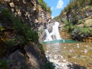 Waterfalls form at nickpoints … places where the slope of the stream changes. Nickpoints can occur when a stream flows across a resistant rock layer, a fault line, or a surface deformation
Where the slope suddenly increases – for instance when the river goes over a cliff, waterfalls form (as in Cameron Falls, Waterton, AB, left). Waterfalls gradually erode backwards, as the water and sediment flowing in the river erodes the bed. As noted above, they erode most quickly in the centre of the stream and less at the banks. creating a characteristic horseshoe shape in wide waterfalls (see the photo of Lundbreck Falls, above).
Waterfalls gradually “move” upstream as they erode their beds. Niagara Falls is moving 1-2 metres upstream every year.
 The pounding water often erodes a basin at the base of the waterfall that is at least as deep as the waterfall is high. The basin, or plunge pool, beneath Niagara Falls is as deep as the falls are high.
4. Braided Streams
Many streams do not have a single sinuous channel, but a number of small, inter locking channels; these are called (logically!) braided channels.
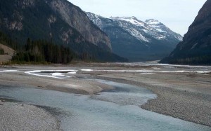 These channels are most characteristic of streams draining glaciers and ice sheets (For example, on the Columbia Icefields map sheet, 83C/3, several of the major rivers draining the glaciers are braided streams … many small channels). Braided streams are common around glaciers because:
- the streams form in the wide, shallow valleys left by glaciers as they retreat
- the valley floor is usually till (loose rock deposited by the glacier), which does not stick together well.
- the banks and bed are easily eroded
- these channels are very active and unstable, constantly changing
 In these stream systems, the entire valley becomes deeper over time. The stream does not erode a single deep channel Rather, as the stream wanders across the valley floor, it gradually lowers the valley floor level.
E. Overbank Flow (Flooding)
Stream flow is not always confined to stream channels. When excessive stream discharge occurs (heavy rainfall, snow melt, etc.) and streams cannot accommodate the water in their normal channels, streams may overflow their banks causing floods.
Most rivers have “flood plains” – areas of low, flat ground bordering the normal stream channel. This area is often flooded annually or semi-annually. This regular flooding deposits new soil and mineral material regularly, making these areas very fertile for agriculture.
Floods are typically caused by heavy rainfall, ice jams in rivers, heavy snowmelt and runoff, and sudden glacial melting and runoff (also called jőkulhaups).
Floods also pose a serious dangers to humans and human activities. For example, in 1887 when the Huanghe (Yellow) River in China flooded, 130,000 square kilometres were covered, killing over 1 million people directly, and several times more due to famine and disease. The 2013 June floods in southern Alberta (Calgary, High River, Canmore, Medicine Hat) caused $5 Billion in damages. The worst natural disasters (in terms of loss of life and damage to property) are floods.
Unfortunately, people like to live on flood plains because these areas provide good fields, flat land, many nutrients, close access to transportation routes, etc. So, engineers devise ways to manage floods as well as possible.
To alleviate floods on the Mississippi, several engineering works have been tried including cutting channels across meander loops to increase velocity and flow. However the river has formed new meanders quickly (usually in someone’s back yard!). Also, emergency flood channels have been built in the lower Mississippi, but these have a limited capacity (the water still has to go somewhere!). Now, attempts are being made to restrict flood-prone regions for agricultural or recreational use. However the river is an important transport route (industries want to be close) and water source (people want to be close). (Note, the flooding with Hurricane Katrina was not really related to river flooding, rather too much rainfall and ocean flooding)
Flash floods occasionally occur with little or no warning in response to torrential thunderstorms which deliver large quantities of water in very short periods of time (20-30 cm per day). These are most common in arid regions with little vegetation. These flash floods can cause large scale washouts.
June 2013 saw the worst flooding (and most costly natural disaster ever) in Canadian history in southern Alberta. There are all sorts of web resources available (great project ideas): see 2013 Alberta floods
Significantly June 2013 also saw
- the worst flooding in 500 years in Europe (2013 European floods) — the worst since the days of Leonardo da Vinci and Henry VIII!
- disastrous floods in North India (2013 North India floods)
Earlier in 2013 (during the southern hemisphere summer), devastating floods hit Australia and Argentina.
Climate change models have accurately predicted that the planet is warming and setting off more frequent extreme weather events: floods, tornadoes, drought, freezing rain, prolonged heat waves or cold snaps … basically everything — from dry to wet, from cold to hot are becoming more extreme and there is less moderation. One of the results appears to be more severe flooding. While some politicians — for political reasons — like to argue this is not happening, the debate among scientists has long been over (we do this next semester). See BBC News – Prof Sir John Beddington warns of floods, droughts and storms
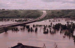 Significantly Alberta has now experienced three major flooding events all described as “floods of the century” by political leaders in less than 20 years (1995, 2005, and 2013). The Oldman River flood, in Lethbridge, in 2001 (left), was supposed to be a “flood of the century,” but was followed by similar floods in 2005 and 2013.
This has led for us to stop using terms like “flood of the century”! That implies nothing is changing over the centuries. in fact, climate change models all predict this will be more and more common in areas like southern Alberta.
Flood Protection
Since floods are potentially so devastating, flood protection is a BIG issue! Flood protection measures typically take the form of
- artificial levees (or dikes) – earth, stone, or concrete embankments built parallel to the channel. In essence, the banks of the channel are raised so that it can hold more water. If the stream flow is large enough, however, it can flow over top of the levee.
- dams – dams are built across the stream. To help prevent floods, dams may provide a large catch basin that can temporarily store water, then releasing it more slowly over time. This manages the rate of stream flow so that the flow is more manageable downstream. If the rain/snow-melt or runoff event is large enough, however, the catch basin can become full and flooding can still occur.
- spillways or floodways – these are artificial stream channels, built to “detour” around valuable assets. For instance, the Red River Floodway in Manitoba is designed to divert the Red River around the city of Winnipeg during potential flooding events.
- restrictive zoning – a more “passive” form of flood protection is to restrict the type of development in flood prone areas. For instance, in the Oldman River Valley, in Lethbridge, AB, all residential, commercial, and industrial buildings were relocated form the flood prone valley floor to the table lands above. Development in the river valley is restricted to park land and other recreational activities which are less valuable if inundated.
III. SEDIMENT IN STREAM SYSTEMS
Streams are very important agents because they transport rock debris and sediment. Normally their sediment load is directly related to their discharge (flow):
– the greater the flow,
– the greater the velocity,
– the greater the entrainment and transport,
– and the more erosive the stream is.
Streams carry materials in solution, in suspension (clays, silts) and by saltation and traction (sands, pebbles). Learn these four terms!!!
-
Point Bars
 Meandering rivers tend to erode on the outside of curves, and deposit materials on the inside of curves as sand or gravel point bars.
This is where no erosion is occurring (the thalweg is on the other side of the stream undercutting the outside bank. Point bars are formed as the secondary flow of the stream sweeps and rolls sand, gravel and small stones laterally across the floor of the stream and up the shallow sloping floor of the point bar. This may also be where water velocity is least, encouraging deposition.
To the left, erosion is happening on the outside of the curve (note the dark “cliff” being undercut). This is referred to as a cut bank. Deposition is happening on the point bar on the right.
2. Flood Plains
When rivers overflow during floods, wide flat plains of sediment are deposited, flood plains (see above, overbank flow).
A variety of features are associated with floodplains including
- levees – natural mounds of sediment adjacent to the stream channel, caused by larger sediment being deposited along the banks (remember, along the banks is were the velocity is least and sediment is most easily deposited). Levees (also known as dikes) can also be built by humans to reduce flooding.
- backswamps – low level areas which are covered during a flooding event, but which are left as small lakes in between floods.
- yazoo streams or tributaries – small creeks that wander in the backswamp areas, but which are unconnected to the main stream channel. These little streams often make traversing floodplain areas unexpectedly treacherous and wet on the feet!
3. Stream Terraces
As rivers erode deeper, old flood plains may be left “high and dry” well above the current flood plain level. These old flood plains are called alluvial or stream terraces.
Because the stream’s channel is now deeper, when it does flood, the water does not reach as high as the original flood plain, so a new flood plain develops. The old flood plain is left perched well above the current flood plain.
4. Deltas
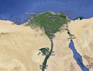 At the mouth of a stream, the velocity drops as the slope decreases and as it encounters the ocean or lake into which it drains. Sediment is deposited because the velocity drops and through the chemical process of flocculation. The resulting depositional features are called deltas. Coarser material is deposited first, closest to the source. Finer material is carried further.
Deltas are often triangular shaped (hence their name, named after the Greek capital letter ∆ – delta): see the Nile River delta, right, for an excellent example.
Most deltas are made up of an intricate variety of low-lying islands made up deposited sediment. These islands are only barely at or above sea level. They are often subject to flooding when either the stream floods, or heavy weather causes high ocean waves. However deltas are also fertile, rich areas, wonderful for agriculture. Periodic flooding is a constant risk, however.
Much of the Fraser River delta around Vancouver (the municipalities of Delta, Richmond, Surrey, etc) are largely deltaic islands at or near sea level. They are protected by extensive dikes, but – in the case of sever weather or earthquake – could be subject to extensive flooding.
Through these islands, the stream disperses into several smaller streams or distributaries, distributing the water toward the ocean or lake.
5. Alluvial Fans
In arid and semiarid environments, alluvial fans are fan-shaped deposits of fluvial sediments. They typically occur at the mouth of canyons where an intermittent stream exits the mountains into a flatter valley. They are produced when a stream (for instance during a flash flood) loses velocity as it emerges from a steep canyon and spreads onto the shallow valley floor. Sediment is sorted with the coarsest materials are deposited at the top of the fans, with the finest materials (silts, clays) being carried furthest down the fan to the valley floor.
Worth reflecting on …
Check out this video clip with physicist David Wilkinson, http://www.youtube.com/watch?v=XyZ1CN6rOc8&feature=c4-overview-vl&list=PLB3B77E1AA52C13B5
For a really thorough introduction to all sorts of topics related to the Bible and Science, visit the information page on the American Scientific Affiliation website: The Bible and Science Page: all sorts of topics and perspectives (the editors’ have no axes to grind) are listed here. Check them out!
In particular, I encourage you to follow the link to Science and the Bible: Are They Incompatible? by Ernest Lucas (from Science and Christian Belief, Vol. 17, No. 2, October 2005, pp. 137-154.
How do you feel about the authors’ comments? Do you agree? Feel free to discuss this on the course discussion site (see the syllabus for details …)
To review …
Check out the resources at www.masteringgeography.com.
This page is the intellectual property of the author, Bruce Martin, and is copyrighted © by Bruce Martin. This page may be copied or printed only for educational purposes by students registered in courses taught by Dr. Bruce Martin. Any other use constitutes a criminal offence.
Scripture quotations marked (NLT) are taken from the Holy Bible, New Living Translation, copyright © 1996. Used by permission of Tyndale House Publishers, Inc., Wheaton, Illinois 60189. All rights reserved

