
The due dates for all labs are on the labs, and in the calendar.
- Print it off.
- Complete it.
- Scan/photo it and send it as ONE PDF document through Canvas. Please DO send it as ONLY ONE PDF document. With the pages in ORDER, please.
- Check to make sure YOU can read it. If you can’t read it, neither can I.
- Late labs will not be accepted.
- The topographic maps required are in the Library, online, or you can purchase your own (see the syllabus for details). PDF versions of the maps you can access online are here: 21H16 Amherst (or an alternative version here) 83C03 Columbia Icefield.
- For Lab 4, here is 82H01 – Milk River, Alberta.
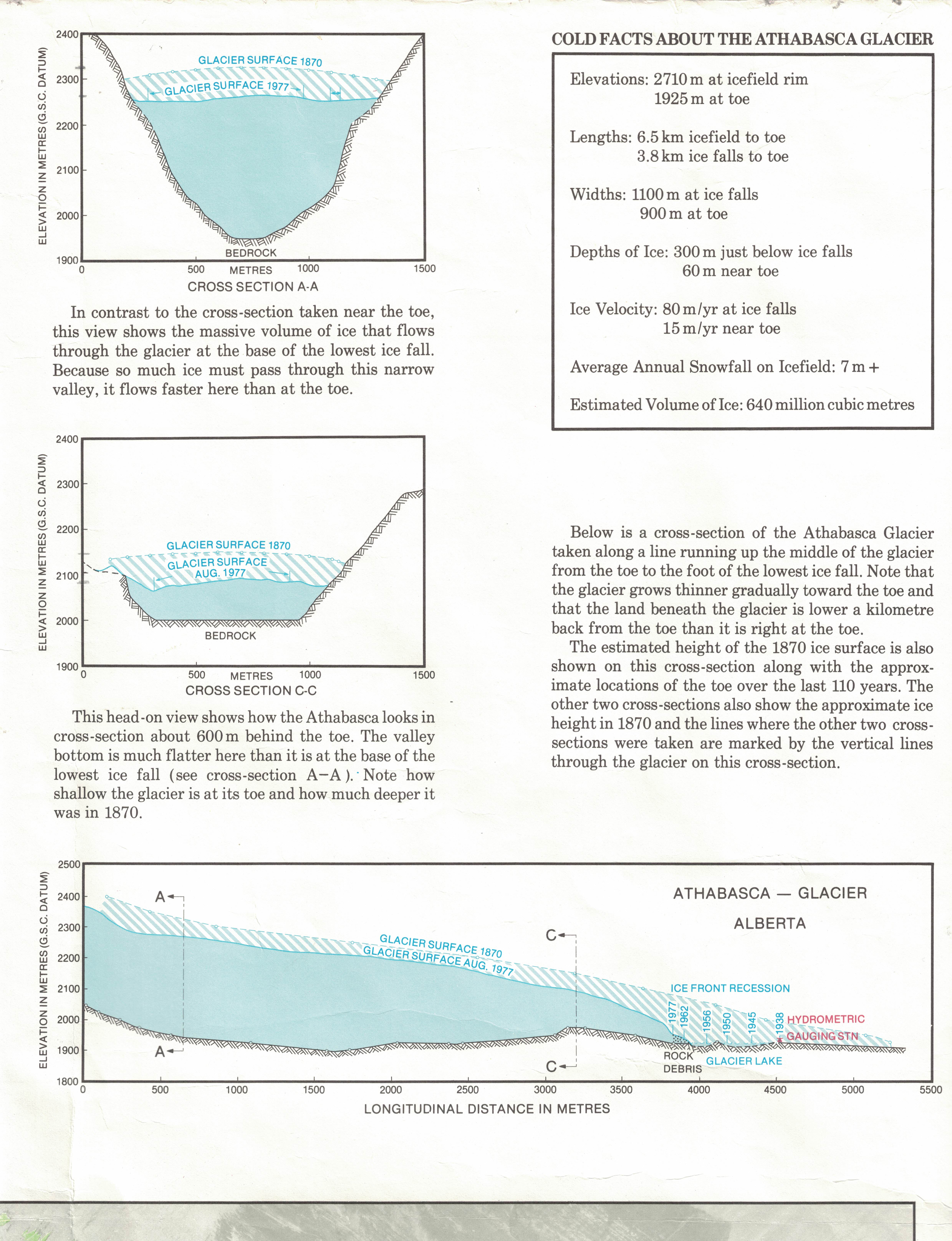
- For Lab 5, here is a clearer cross-section of the Columbia Icefield glacier
- A key to symbols on NTS maps is found here: NTS Map Symbols
You are encouraged to work on your labs in partners or in groups. Often it is helpful to interact with other students — great! However you must hand in your own lab! (Remember, your partner[s] may not be correct, anyway!).
Lab 1 Lab 2 Lab 3 Lab 4 Lab 5 Lab 6
These labs are all copyright © by Bruce Martin. They are the intellectual property of the author, Bruce Martin. The labs may be printed and used only by students registered in Geography 1013 at Crandall University. Any other use of the labs is a criminal offence.